


Moggs Strangers Guide to London
Republished Map laid onto cloth
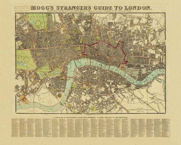
Mogg's New Plan of London originally published circa 1837 by Edward Mogg. A list of 900 principal places below the map.
Extent: Pentonville - Stepney Church - Newington Butts - Knightsbridge
Taken from the original antique copper engraved map or plan first published in 1806 by Edward Mogg. The map was continually updated and this edition was published in 1837. Extending from Hyde Park in the west to the Mile End Road in the East and from Pentonville in the north to Kennington in the South. At the bottom of the map is "A list of 500 of the principal places with references to their situation in the above plan".
When this map was published:
In England Queen Victoria ascended to the throne and the architect Sir John Soanes, designer of the Bank of England, dies. Overseas Britain entered Afghanistan preventing the Persians from occupying Heart and in America the Sioux give up their lands on the Mississippi river. Edward Mogg was a cartographer who flourished in the early to mid 19th century. He worked from 51 Charing Cross and engraved and published a number of fine maps of London. The population of London in the 1831 consensus was 1,474,000 rising to 1,870,000 by the census of 1841.
Size: 16'' x 20''
All folding maps are presented in handmade slip cases. Please be aware that colours may vary and can't be chosen.